
Consumer.info - Got Data?

America’s Greatest Storyteller Is the Census
The same veteran statistic can tell a neighborhood story, a city story, a county story, a regional story, or a national story. The number may stay familiar. The meaning changes with the map.
Search Consumer Intelligence
Search companies, complaints, cities, ZIP codes, products, maps, and consumer research.
Key Findings
📖 The Story
Why geography changes what the same number means.
Americans often repeat a reassuring phrase: numbers do not lie. That is not quite enough. Numbers can be selected, stripped of context, averaged until their sharp edges disappear, or presented at a scale so broad that the human story becomes invisible. Data does not speak for itself. People decide which number to show, which boundary to draw, and which history to preserve.
The United States Census is one of the country’s greatest storytellers because it records America at more than one scale. It can describe a neighborhood, a ZIP-like area, a city, a county, a metropolitan region, a state, or the nation. Each level is factual. Each level is useful. Yet each level answers a different question.
That matters in an age when public history can be shortened, softened, forgotten, or deliberately erased. A plaque may disappear. A building may be renamed. A public record may be buried. But carefully preserved demographic evidence can still show where people lived, how communities changed, where hardship concentrated, and which populations were overlooked.
Veterans are a powerful example. A national veteran count measures scale. A state rate supports policy. A county estimate guides funding. A ZIP-area profile connects people to nearby services. A census tract reveals that one neighborhood may contain a striking concentration of older or disabled veterans while the tract next door does not.
All values in this article are hypothetical and are used only to demonstrate how Census geography changes interpretation.
🗺 The Geography
One population, many scales of truth.
Census Tract
A tract is a neighborhood-scale statistical geography. It is where regional averages begin to break apart into local patterns.
Best for neighborhood maps, clinic access, transportation, veteran housing, and local service planning. Smaller samples can carry larger margins of error.
ZIP / ZCTA
A ZIP Code Tabulation Area is the Census Bureau’s statistical approximation of a ZIP service area. Consumers recognize ZIPs, making this level useful for public lookup.
Best for ZIP profiles, local resources, comparison maps, and consumer search. ZCTAs do not always align cleanly with cities or counties.
Place / City
A place profile describes residents inside a city or other Census-defined place. It aligns closely with municipal boundaries and public services.
Best for city services, municipal veteran programs, transit, housing policy, and local accountability.
County
Counties are stable, recognizable, and tied to healthcare systems, courts, budgets, emergency management, and major public programs.
Best for budgets, hospitals, regional comparisons, national maps, and program planning. County averages can hide neighborhood extremes.
Metro
A metropolitan area follows a connected labor, housing, and commuting market rather than one government boundary.
Best for workforce analysis, housing, commuting, regional healthcare, and military-related economic research.
State
A state profile is broad enough for legislation, funding, statewide policy, and comparison with other states.
Best for statewide budgets, legislative analysis, rankings, funding formulas, and national state maps.
📊 The Same Field, Different Meaning
The variable can stay constant while the public question changes.
| Geography | What it tells you | Best use | Main caution |
|---|---|---|---|
| Tract | Veteran concentration in one neighborhood-scale area | Local maps and service access | Larger margins of error may occur |
| ZIP / ZCTA | Veterans in a familiar local service area | Consumer lookup and local resources | ZCTAs approximate ZIP areas |
| Place / City | Veterans inside municipal boundaries | City policy and services | Suburban residents may be excluded |
| County | Veterans across a regional government area | Budgets, hospitals, and national maps | Local variation can disappear |
| Metro | Veterans across a connected economic region | Workforce, housing, and commuting | Boundaries may be less familiar |
| State | Statewide population and policy scale | Legislation, funding, and rankings | Too broad for local decisions |
| Country | The national benchmark | Historical context | Nearly all local variation is lost |
⚖ Counts Versus Rates
Two truthful numbers can answer two different questions.
Veteran Count
How many veterans are here?
Counts help estimate demand for clinics, transportation, housing assistance, legal services, benefits counseling, and community programs.
Veteran Rate
How concentrated are veterans here?
Rates make places of different population sizes more comparable. They are usually better for choropleth maps and rankings.
🧭 The Map
Choosing the right geography for Datawrapper and public visualization.
For a national map, counties often provide the best balance of detail, public familiarity, statistical reliability, and rendering performance. State maps are simpler, but they flatten local differences. Census tract maps are powerful for local investigations, but usually too dense for a national view.
Important statistical caution
Small-area estimates can carry larger margins of error. A dramatic tract percentage should be reviewed alongside the estimate, denominator, and margin of error before it is described as a meaningful difference.
🧠 The Intelligence
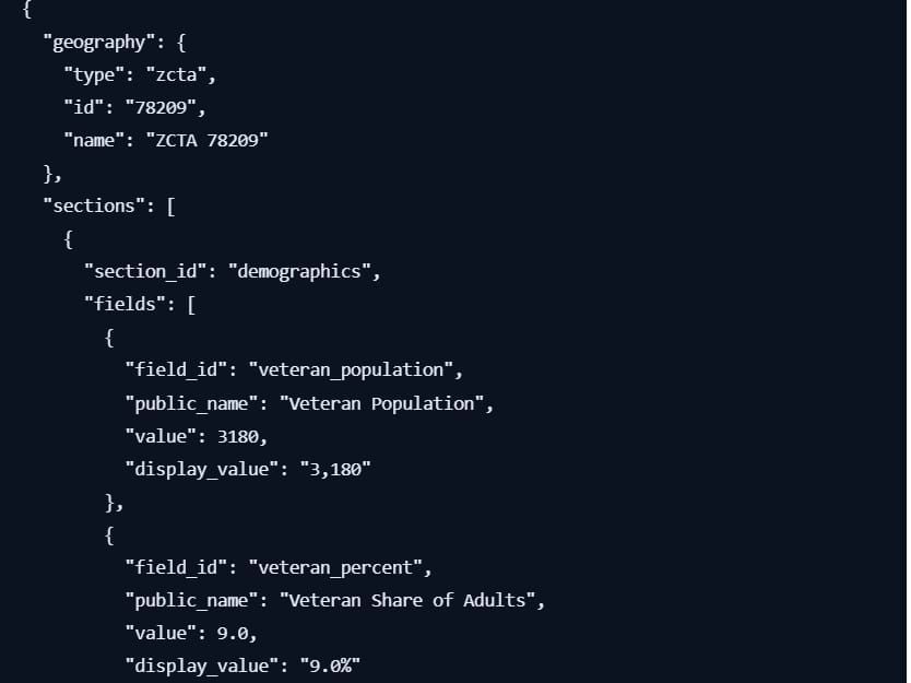
A reusable profile structure for every geography.
The strongest public-data system does not build a separate website for every geography. It builds one governed profile structure and changes only the geographic identity.
🕯 The Memory of a Nation
Why preserving public data is also a form of preserving history.
The Census is often treated as a technical institution: forms, tables, estimates, margins of error, and geographic codes. But beneath that machinery is a democratic idea. People should be counted. Communities should be visible. Change should be measurable. Public decisions should leave an evidentiary trail.
That trail becomes especially important when institutions forget, minimize, or revise uncomfortable parts of the past. Data cannot replace oral history, archives, journalism, photographs, testimony, or lived experience. But it can document that a population was present, that a disparity existed, that a neighborhood changed, or that a public need was concentrated in a place officials might otherwise overlook.
Veterans are a powerful example because their lives cross nearly every public system: healthcare, housing, disability, employment, transportation, education, aging, family life, and income. A national total honors scale. A state map informs policy. A county profile directs resources. A ZIP search helps a family find services. A tract map reveals the neighborhood where support may be most urgently needed.
Numbers do not automatically tell the truth. They require context, honest labeling, sound methodology, and responsible interpretation. But when those conditions are met, public data can resist forgetting. It can challenge convenient narratives. It can expose the distance between a statewide average and a neighborhood reality.
The Census is America’s greatest storyteller because it does not ask us to accept one version of the country. It gives us the evidence to look again—closer, wider, and deeper.
Explore Consumer Intelligence
Browse our growing collection of consumer intelligence, complaint investigations, company profiles, rankings, maps, and financial research.
📊 Complaints
Consumer complaint trends, investigations, and analysis.
🏦 Companies
Company profiles, complaint history, and accountability.
📈 Credit
Credit reporting, credit scores, disputes, and credit intelligence.
💳 Debt
Debt collection, collections, repayment, and consumer protections.
🏛 Banking
Banks, fintech, checking accounts, payment systems, and financial services.
🏠 Mortgages
Mortgage lenders, servicing, foreclosures, and home finance.
💵 Loans
Auto loans, student loans, payday loans, and personal lending.
🛡 Identity Theft
Identity protection, recovery, monitoring, and fraud prevention.
⚠ Scams & Fraud
Fraud alerts, scam investigations, phishing, and consumer warnings.
⚖ Lawsuits
Consumer litigation, settlements, enforcement actions, and class actions.
🔎 Investigations
Data-driven investigative journalism and consumer accountability.
🏆 Rankings
Top companies, worst offenders, complaint rankings, and scorecards.
🗺 Maps
Interactive complaint maps, ZIP rankings, and geographic intelligence.
🇺🇸 States
Consumer intelligence by state.
🏙 Cities
Complaint trends and company intelligence by city.
📚 Research
Methodologies, datasets, technical papers, and evidence.
🧭 Consumer Guides
Know your rights and learn how to solve common consumer problems.
🗄 Data Center
Interactive dashboards, APIs, downloadable datasets, and statistics.
Methodology note: The veteran figures in this article are hypothetical examples created to explain Census geography. They are not presented as official current estimates for any named place.


